
Trans Telapak Buruk – Berembun Jelebu: Uncovering The Mysterious WWII Aircraft Crash Site

Somewhere in the dense rainforested mountaintop in Negeri Sembilan is a burial site of a half-century-old plane wreckage from World War II. Lies 1193m above sea level is Gunung Telapak Buruk of Negeri Sembilan, a Royal Air Force B-24 Liberator crashed and killed all eight members of its crew. The fate of the bomber and its eight crew was a mystery for over 60 years.
Decades came and gone, and it was more than 60 years later when the ill-fated plane and its crew remains were found. Since then, the mountain became a popular tourist attraction among history buffs and hikers.
With such an interesting historical event tied to this plane wreckage and its proximity to the heart of Kuala Lumpur (about an hour away), it is not hard to see why people has been attracted to visit this place.
Reunion of The Tahan Team
The plan of hiking Telapak Buruk came in mind when I posted on Facebook, asking if anyone had any plans for one of the weekend I’m in Negeri Sembilan. Since I had a personal matter to attend to on Saturday, I had the Sunday available to do a day hike before returning to Singapore. In the end, Uncle Mak suggested doing a Trans Telapak Buruk – Berembun. Since I didn’t previously have the chance to visit the aircraft crash site, I immediately agreed to join.


🔼 (Back row) Left to right: Uncle Mak Hon Leong, Steven, Lesvin, Hooi Chin, Terry, Wills, Uncle Mak Hon Kong
(Front row) Left to right: Callchun, Harriet, me, Eunice
The conversation on Facebook attracted our previous Tahan comrades and joining us this time around are – Uncle Mak Hon Kong, Wills, Hooi Chin, Eunice, Callchun, Steven, Lesvin, Harriet and Terry.
How To Get There
There are basically two entrances to get to the crash area, one from Gunung Berembun Jelebu and the other from Gunung Telapak Buruk
Trail heads:
★Via Gunung Berembun Jelebu |Kampung Pantai Baru Trailhead
Loji Rawatan Air Pantai, Mukim Pantai,, 71770 Seremban, Negeri Sembilan, Malaysia
★Via Gunung Telapak Buruk | TM Telecommunication Tower
71600 Kuala Klawang, Negeri Sembilan, Malaysia
In terms of accessibility, Kampung Baru Trailhead is the most convenient as you don’t need a 4wd unlike TM Telecommunication Tower with poor road conditions. Imagine driving a normal sedan along rugged gravel road? No way!
However, there is always a trade-off, and in this case, the aircraft crash site is only about 1 hour away from TM Tower and Gunung Telapak Buruk but 4.5 hours away from Kampung Pantai Baru trailhead.


🔼 Special thanks to the Mak brothers who provided their 4wd for this trip
Since Uncle Mak Hon Kong had newly purchase a 4wd, we decided to do a Trans, starting from TM Tower where the peak of Gunung Telapak Buruk is, then descend to the plane wreckage, before continuing to Gunung Berembun and out through Kampung Baru trail head.
Update: I did another hike from Kampung Pantai trail head in July 2019. More on the hike here
Gunung Telapak Buruk
We started our trip early and gathered at Kampung Pantai trail head as early as 6.30am. This was where our trek would end and where we parked our cars. All of us then squeezed into a 4wd and drove to TM Tower where Gunung Telapak Buruk is.


🔼 Navigate to TM Telecommunication Towers, where the trail head lies

🔼 The trail starts from the Digi Telecommunication Tower behind
The journey takes roughly half an hour and in no time, we reached Stesen Pemancar Gunung Telapak Buruk. Once there, you shall see TM Telecommunication tower on the left, while the peak of Gunung Telapak Buruk is on your right. Be sure to snap a photo or two in front of the peak signage, as you have reached Gunung Telapak Buruk, taa-dah!

🔼 Gunung Telapak Buruk 1193m


🔼 Uncle Mak (twin #1), Uncle Mak (twin #2)

🔼 Eunice and Callchun
The trail that led us to the plane wreckage is only a few steps away, right next to Digi Telecommunication Tower.

🔼 Follow this path next to Digi Tower, the gateway to plane wreckage
WWII Aircraft Crash Area
We started our hike around 8am, after gearing up and taken enough photos with the signage of Gunung Telapak Buruk. One interesting thing to note is that the trail leading to the crash site goes downhill instead of uphill, as we were to head approximately 2.5km down the valley to where the plane wreckage is.


The route is rather flat at most times, and is wide and clear, making the trek really easy. There are paper markings every 50m so once you reach the mark of 2550m, be sure to pay attention to the green signage of the crash site on your left. The trek from the starting point took us less than an hour (in leisure pace).


🔼 Look out to these metal plate | By Excellent & Wonderful E&W Club


🔼 Interesting mushrooms and fungi found along the trail


🔼 Look out to these metal plate | By Excellent & Wonderful E&W Club

🔼 Look out to these metal plate | By Excellent & Wonderful E&W Club
On your right, there’s another metal plate on a tree, with a Malaysian national flag hanging proudly right underneath the metal plate.

Follow the trail downhill and you will find the plane wreckage. As you go down the steps, you will gradually find various plane debris scattered around. The wreck, though widely spread over a large area, is well preserved, including sections of the wings, the fuselage, the engine, and even some faint markings.


🔼 Short break before we start exploring the wreckage

🔼 Section of the wing found on the other side

🔼 Various debris found along the path to the crash site

🔼 With my girls

🔼 Another part of the plane, covered by fallen leaves and branches

🔼 Left: See closely, there are words on the plane | Right: Let's take a photo

🔼 Is this the engine?
From the photos I’ve seen circulated on the internet, the fuselage had only been hit by a fallen tree in recent years, which further damaged the aircraft.

🔼 The fuselage (main section of the plane)

🔼 A must-snap photo with the plane

🔼 A metal plate with the names of the 8 deceased crews

🔼 A fallen tree trunk had crushed the plane

🔼 Haven't seen this girl for a year and she's now engaged! Congrats my friend :)


🔼 Isn't this place instagrammable?

🔼 Keep posing for the camera

🔼 Even if I'm tired and sleep deprived

🔼 Crushed wing

🔼 Peek-a-boo!

🔼 Our re-creation of the famous shot in Taiwanese movie,"You Are The Apple of My Eyes"

🔼 What's inside of the plane

🔼 Let's take a photo outside since we could't go in

🔼 Still intact wheel

🔼 A closer look
As tempted as you could be to be taking photos with the wreckage and debris, try your best not to destroy any part of the plane you see. I understand the urge to touch, hold, sit and lean on the plane, but do bear in mind that it is more than 70 years old and they can be quite fragile, and dangerous as well. You really don't want to injure yourself in the event that it collapse.

🔼 Trying to look cool

🔼 unknown part of the plane
One question I've been asking myself is whether it is the right thing to do - sitting and standing on the plane itself. I didn't actually give it any thought when I instinctively did it back then, but I do have some conflicting thoughts about it right after. After all it's a historical site (though not a protected area / restricted area by law) and a burial site of the ill-fated crews. Was it a disrespect and irresponsible act? Will I further damage the debris?


🔼 Climbed onto the wrecked plane for a photo, but immediately felt bad for possibly damaging this further
Given a second chance, I probably would have not climb onto the plane but rather stand just next to it for photos. But what's done is done and there is no turning back. For those of you who plan to revisit, it's your own judgment to make. But one thing's for sure - whatever it is, don't put yourself and others in danger.


🔼 What kind of an insect is that? Any idea?
While I contemplate whether it is ethical to climb onto the debris, some of you may have another question in mind about the plane.
What exactly happened to this aircraft? What was it doing in our Malaysian jungle and how did it crash?
Time for a little story telling...
The Story Behind
Eight days after Japan surrendered during the end of World War II in August 1945, eight crew members onboard British Royal Air Force (RAF), flew a B-24 Liberator Bomber to the Malay Peninsula on a mission to drop supplies of food and medicine for Allied POWs, still imprisoned and in poor health, in a camp at Kampung Langkap not far from the crash site.


🔼 Instead of calling this "the aircraft" or "the plane", you may also refer to it as the B-24 Liberator Bomber or KL654-R
The aircraft took off from their base at Brown’s West Island airstrip in the Cocos Island around 1,000km south of Sumatra along with four other B-24 from Squadron 356. Without any distress signal and with no indication of trouble, the plane disappeared. For decades, it was thought to have fallen down into the ocean or crashed somewhere into the dense Malayan jungle.
In the 1950s, the crash site was first discovered by orang asli tribesmen who reported it to the British Army. However, no action was taken for fear of an ambush by the communist insurgents. In 1991, local Orang Asli tribesmen once again reported a remote wreckage site to the authorities, but expedition to examine the site did not begin until much later in 2006, due to lack of funding and initial reluctance by the UK Ministry of Defence to support recovery of the remains.


🔼 What has become of the aircraft which once belonged to the British Royal Air Force
In 2006, the Malaya Historical Group (MHG), following two expeditions to the wreck site, positively identified the reported wreckage as the missing B-24 Liberator. The following year, MHG organized another trip with involvement of the Malaysian Army and two British participants, former Apache pilot and author Ed Macy and police detective Clayton Ford. They recovered two rings, a pocket knife, a watch strap and bone fragments.
A thorough, 10-day excavation was done in 2009, which recovered bones, identity tags and personal belongings. The bone fragments recovered was then DNA tested to confirm their identities. Researchers believed that the plane had struck a tree and crashed down the dense forest.


🔼 Nature has taken over the plane with moss growing all over the debris
The remains of eight crew members of RAF flight KL654-R were permanently laid to rest on 18 October 2012 in a burial service with full military honours at the Cheras Road Cemetery, Kuala Lumpur, some 67 years after their B-24 Liberator crashed.
With the consent from the family members of the crews, their remains were buried in one coffin but have individual headstones. Their names are:
Flying Officer J.T. Bromfield, 166369 from Cheam, Surrey (20 years old)
Flight Sergeant A. Turner, 1621393 from Dewsbury, Yorkshire (21 years old)
Flight Sergeant William Ross, 2213814 from Gateshead, Durham (20 years old)
Flight Sergeant Jack Blakey, 1582692, from Boston, Lincolnshire (30 years old)
Flight Sergeant Raymond Arthur Towell, 1624252, from Wellingborough, Northants(21 years old)
Flight Lieutenant John Selwyn Watts, 158017, from Crofton, Yorkshire (24 years old)
Flying Officer Edward Donald Mason, 166082 from Sheffield, Yorkshire (22 years old)
Flying Officer William Kenneth Dovey, 166352 from Ludlow, Salop (20 years old)
🔼 In memory of the deceased crews
It's quite a heart-breaking story of the young crews who died in such an unfortunate accident. Fortunately, with the recovery of their remains and a proper burial, their family members finally got their much-needed closure.
Gunung Berembun Jelebu
With almost an hour spent on the crash site, we finally continued our journey to Gunung Berembun which is another hour away. The trail goes downhill (again), so it’s a pretty easy hike for most people. It took me an hour as I was wearing my new hiking boots, but for the fast ones, it is reachable in 45 minutes or less.


🔼 Gunung Berembun Jelebu 1014m

🔼 Lunch break at the trig station
Although it was only around 10.45am when we reached Gunung Berembun, we decided to take a break and had our early lunch. As we gathered underneath the trig beacon, we made instant noodles and hot tea (and coffee) while chatting about random topics and reminisced our past hikes together. Soon, an hour passed, and it was finally time to move on to Gua Kambing.


🔼 "Award ceremony"


🔼 "Mugshots"
However, Uncle Mak had to turn back to Gunung Telapak Buruk in order to retrieve the 4wd. He was supposed to drive his Viva to collect his 4wd after coming out through Kampung Pantai Baru trail head but seeing the road condition in the morning (on our way in), he was reluctant to drive his Viva through that rugged road.

With one final group photo to commemorate our hike of the day, we said goodbye (temporarily) to Uncle Mak, before proceeding to Gua Kambing.

🔼 Our hero of the day was going to hike back to our car

🔼 The mamak--stall-looking Gua Kambing
We reached Gua Kambing in only half an hour, where we took another 45 minutes break just to kill time. After all, it’d take Uncle Mak some time to hike back (this time uphill) to Gunung Telapak Buruk then having to drive the 4wd to our meeting point. As we found no reason to rush, the guys enjoy their coffee break while I look around the beautifully decorated shelter.


🔼 A creek where water is coming out from


🔼 Gorgeous Harriet and Sweet Eunice
Gua Kambing is a rather interesting campsite, with water source and a sheltered rock cave. Past frequent hikers had also decorated the place into a comfy selter with tables, fly sheets and decorative mail box. How lovely! It’s a great spot to rest and have a nice cup of tea, especially for those ascending from Kampung Pantai Baru.


🔼 Last water point before Gunung Berembun peak (if you trek from Kampung Pantai Baru)


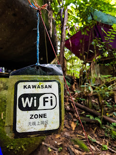
🔼 Modern vs Old School - WIFI vs mailbox
There, we also spotted a jackfruit tree, and the guys decided to pick two of them home. Luckily, we were descending, hence the weight didn’t add too much of a burden to them, not that it’d be a big challenge to these fast legs even if we were to trek upwards anyway.


🔼 Jackfruit tree spotted. Look at the size of the jackfruits they took home!
Goodbye My Friends


🔼 Lata Berembun
After “stealing” two jackfruits, we made our way down to Lata Berembun which was another 45 minutes away. I was rather slow as my new boots are killing me (also because of lack of exercise) but for the fast ones, they were there at least 10 minutes before me.


It’s a small waterfall with a pool for dipping, but we didn’t go in as we needed to get out and meet Uncle Mak. Besides, I’ve got a bus to catch back to Singapore, so after crossing the river, we continue trekking to Kampung Pantai Baru trailhead which is another half an hour trek away. By the time we were out at 2.20pm, Uncle Mak had also returned with the 4wd. Perfect timing?

🔼 Stream crossing


🔼 Lata Berembun
It’s a small waterfall with a pool for dipping, but we didn’t go in as we needed to get out and meet Uncle Mak. Besides, I’ve got a bus to catch back to Singapore, so after crossing the river, we continue trekking to Kampung Pantai Baru trailhead which is another half an hour trek away. By the time we were out at 2.20pm, Uncle Mak had also returned with the 4wd. Perfect timing?

🔼Our end-point which is the starting point for most people

🔼Peach gum tong sui from Eunice
After drinking a bowl of peach gum soup (courtesy of Eunice), we washed up with pipe water near the trail head, before changing into a set of clean clothing and bid goodbye to each other, promising to meet again next time.


🔼 Ended my trip with delicious lunch on the way to Seremban bus terminal, to board a bus back to Singapore
PS: Special thanks to the Mak brothers who made all the arrangement including providing your brand new 4wd. Till our next hike together!
Epilogue
Being an impromptu weekend hike, I never thought of what exactly to expect from this trip. However, the visit to the final resting place of the B-24 Liberator was quite eye-opening. Knowing how dense our Malaysian rainforest is, it wasn’t surprising to know that it took so long for the plane and deceased crews to be found. Though it took 70 years for the crews to be finally found, at least the family members finally got their much-needed closure.
Today, Gunung Telapak Buruk and the crash site are no longer as obscure as before. More people have become aware of the final resting place of the ill-fated aircraft, and the trail to the crash site is so easily accessible, anyone with an average fitness level could make their way here.

However, it’s important to create awareness among the future (and current, ongoing) visitors to respect the place by not taking any “souvenir” home, as well as not damaging the site. Let us all admire the place without destroying anything, and may our future generations be able to see the wreckage in the same state we now do.
However, it’s important to create awareness among the future (and current, ongoing) visitors to respect the place by not taking any “souvenir” home, as well as not damaging the site. Let us all admire the place without destroying anything, and may our future generations be able to see the wreckage in the same state we now do.
---------------------------------------------------------------------------------------------------------------------------------------------------
Thank you for reading all the way till the end. Too much info and you just want a summarised itinerary but too lazy to scroll back up? Here’s a summary I’ve drafted up for you. Hope it helps you with your planning.
Itinerary:
**Disclaimer: Below is my timing according to my speed. So please take it with a grain of salt, as everyone have different pace. Have fun hiking this mountain. *wink*
Day Hike
Total distance hiked: 9.5km (one river crossing)
0630: Gather at Kampung Pantai Baru trailhead
0700: Drive to TM Tower Gunung Telapak Buruk
0745: Arrive at Gunung Telapak Buruk (Photo at peak)
0800: Start hiking
0850: Reach WWII Aircraft Crash Area
0900: Photo at WWII Aircraft Crash Area
0945: Continue to Gunung Berembun Jelebu
1045: Reach Gunung Berembun Jelebu (break 1 hour - lunch and rest)
1145: Continue to Gua Kambing
1215: Reach Gua Kambing (break 45 minutes)
1300: Continue to Lata Berembun
1345: Reach Lata Berembun
1420: Reach Kampung Pantai Baru Trailhead
Alternative hiking route:
***Disclaimer: The following tips are formed based on my personal opinion. As I’m not a mountain guide nor professional hiker, please exercise your own judgment before following.
🔼 Kampung Pantai Baru Trailhead > Lata Berembun > Gua Kambing > Gunung Berembun > return
This is a rather short hike, which only covers one peak (Gunung Berembun Jelebu). Perfect for beginners or anyone looking for a leisure hike, and doesn’t mind not seeing the Aircraft Crash Area. You also doesn’t need any 4wd to do this hike.
🔼 Kampung Pantai Baru Trailhead > Lata Berembun > Gua Kambing > Gunung Berembun > WWII Aircraft Crash Area > return (more on this here)
If you start your hike early, and have enough time and energy, you can extend your hike to the aircraft crash area before returning to the trailhead.
Update: I did this hike in Jul 2019. More about this here
Update: I did this hike in Jul 2019. More about this here
🔼 Kampung Pantai Baru Trailhead > Lata Berembun > Gua Kambing > Gunung Berembun > WWII Aircraft Crash Area > Gunung Telapak Buruk (Trans)
This is the opposite of what we did but more taxing, since it’s ascent all the way. However, you will need to arrange a 4wd to pick you up at the end of the trek.
🔼 Gunung Telapak Buruk > WWII Aircraft Crash Area > Gunung Berembun > Gua Kambing > Lata Berembun > Kampung Pantai Baru Trailhead (Trans)
This is the what we did, and as you have read above, is rather easy since it’s descent all the way, but would need a 4wd to get to TM Tower Gunung Telapak Buruk, and have cars prepared at the end of the trek (Kampung Pantai Baru Trailhead). You would also need to arrange another 4wd to drive someone back to TM Tower to collect the 4wd. Hmmmm, there’s a lot of cars needed for one hike.
🔼 Gunung Telapak Buruk > WWII Aircraft Crash Area > Gunung Berembun > return
If you have a 4wd, but unable to arrange another one to drive you back to TM Tower, then a trans (either route 3 or 4 above) is rather troublesome to do. In that case, you may make a u-turn from Gunung Berembun back to your 4wd.
🔼 Gunung Telapak Buruk > WWII Aircraft Crash Area > return
Even shorter distance and fairly easy, if you have the same concern as above, and only wanted to visit the Aircraft Crash Area.
🔼 Kampung Pantai Baru Trailhead > Lata Berembun > Gua Kambing > Gunung Berembun > WWII Aircraft Crash Area > Gunung Telapak Buruk > return (Trans reverse)
Don’t have a 4wd but wanted to get to cover both peaks? If you don’t mind a long hike of more than 12 hours, this is one possible way, by starting from Kampung Baru trailhead which is accessible by car, and make a return from Gunung Telapak Buruk.
🔼 Gunung Telapak Buruk > WWII Aircraft Crash Area > Gunung Berembun > Gua Kambing > Lata Berembun > Kampung Pantai Baru Trailhead > return (Trans reverse)
Well, the exact opposite of the above, if you only have one 4wd and couldn’t arrange other transport to pick you up at Kampung Pantai Baru Trailhead and collect your 4wd. However, do expect to spend more than 12 hours for entire journey.
---------------------------------------------------------------------------------------------------------------------------------------------------
Bonus read: How many Gunung Berembun is there in Malaysia?
When I was first exposed to the mountains of Malaysia, I often got confused with the same name shared by different mountains. One of such example is the name “Berembun” which seems to be a well-liked name for mountain-namers (if there is such a person?) If you have ever been confused like I do, here’s three different Gunung Berembun to help you differentiate them, the next time you come across this name:
☆Gunung Berembun (Jelebu) – 1014m/3326 feet
What’s this list without the mountain of the post? Otherwise a forgettable mountain due to lack of scenery and challenge, this mountain is receiving much love in recent years due to the plane wreckage. It is also the lowest mountain of the three listed here, and probably also the easiest.
☆Gunung Berembun (Cameron Highlands) – 1840m/6037 feet
Nestled among the tons of trails in Cameron Highlands, Gunung Berembun is one of the 14 known trails in Cameron Highlands. I’ve yet to try this hike, but from what I’ve read, it was a rather easy trek. Maybe someday I’ll make a visit.
This mountain is located in Terengganu, in Hutan Lipur Chemerong, and is probably one of the hottest camping spot in recent years. The highlight here isn’t this mountain, but the clear water of Sungai Bangang and the beautiful Lansir and Chemerong waterfall. If you have not read my top post, here’s the entry about my visit to this place, back in 2017.

You may have noticed that all three Gunung Berembuns, though located at different states, do in fact share a similarity. All three peaks have no view to write home about, as the summit is overgrown with trees and bushes.
The name “Berembun” in Malay language means “dewy”, so maybe morning dew were found amongst the trees in early morning (low temperature, especially Cameron Highlands)?
What do you think? Did I miss any? Comment down below if you found any more Gunung Berembun which I have missed!
---------------------------------------------------------------------------------------------------------------------------------------------------
-Thanks for reading-


Such a wonderful adventure and I had a great time with your blog. Wanna try this someday.
ReplyDeleteThank you for sharing this with us.
affordable lodge in bangkok
Waa.. i didnt there is a wreckage of ww2 plane in Negeri Sembilan. Thank you for the information. I will invite my friends to hike to that place
ReplyDeleteHi Siti, enjoy your hike, but do make sure to download an offline map online is non of you know the way. There have been too many cases of people getting lost in the jungle. :)
DeleteHi,do you have any contact for the 4WD?thanks....
ReplyDeleteHi, unfortunately I don't :(
Delete